Historic Maps
Maps to help tell Our Park Story!
Historical Maps of Our Park
Historical Maps of Parkland from 1776
Historical maps help us to see our land from a different prespective. Understanding that we inherited our parkland from community's ancestors - and reminding us that we will be leaving it for our community's decedents.

Click on Map to Enlarge
Long Island, New York (1776)
NYPL Archives shows this map of Long Island during the Revolutionary War.
TITLE
The seat of action between the British and American forces: or An authentic plan of the western part of Long Island, with the engagement of the 27th August 1776 between the King[']s forces andthe Americans : containing also Staten Island, and the environs of Amboy and New York, with the course of Hudsons River, from Courtland, the great magazine of the American Army, to Sandy Hook.
NAMES
Holland, Samuel, 1728-1801 (Surveyor)
Click on Map to Enlarge
Connecticut and parts adjacent, (1780)
NYPL Archives shows this map of Conneticuit, including Long Island across the sound, soon after the Revolutionary War.
TITLE
Connecticut and parts adjacent
NAMES
Covens et Mortier et Covens, junior (Publisher)
Klockhoff, H. (Hendrik) (Engraver)
Romans, Bernard, 1741?-approximately 1784 (Associated name)

Click on Map to Enlarge
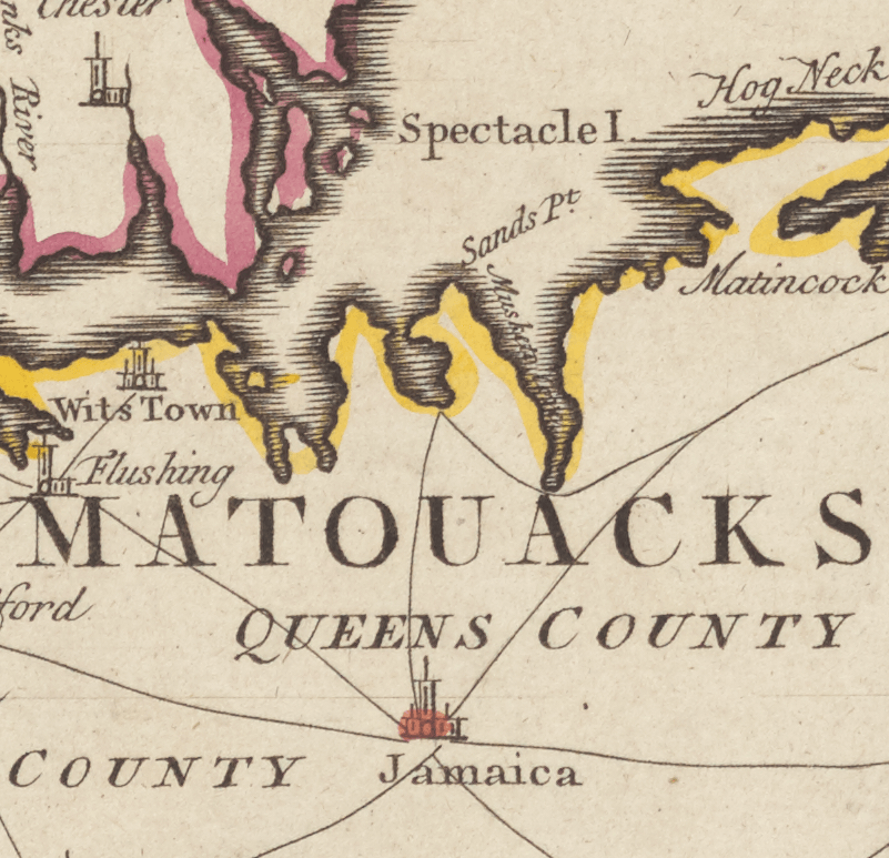
Long Island, (1867-1874)
NYPL Archives shows this map of Long Island. Focusing on the line and properties of South Side Railroad company.
TITLE
Map of Long Island: showing the line and property of the South Side Railroad of Long Island
NAMES
G.W. & C.B. Colton & Co. (Engraver)
South Side Railroad of Long Island (Publisher)

Click on Map to Enlarge
Bayside (1909)
NYPL Archives shows this map of Long Island. Focusing on the line and properties of South Side Railroad company.
TITLE
Plate 27: Bounded by Bell Avenue, Shore Avenue, Little Neck Bay,... Bayside Boulevard, Edgewater View, Ashburton Avenue, Bayside Boulevard, 10th Street, Broadway (Douglas Pond), Bayside Avenue, Titus Avenue, Highland Avenue, Highland Street, Crocheron Avenue, Gardner Street, Vista Avenue, Bayside and Little Bayside Road.
Additional title: Part of the Borough of Queens, Flushing, Ward 3.
NAMES
G.W. Bromley & Co. (Publisher)
Click on Map to Enlarge
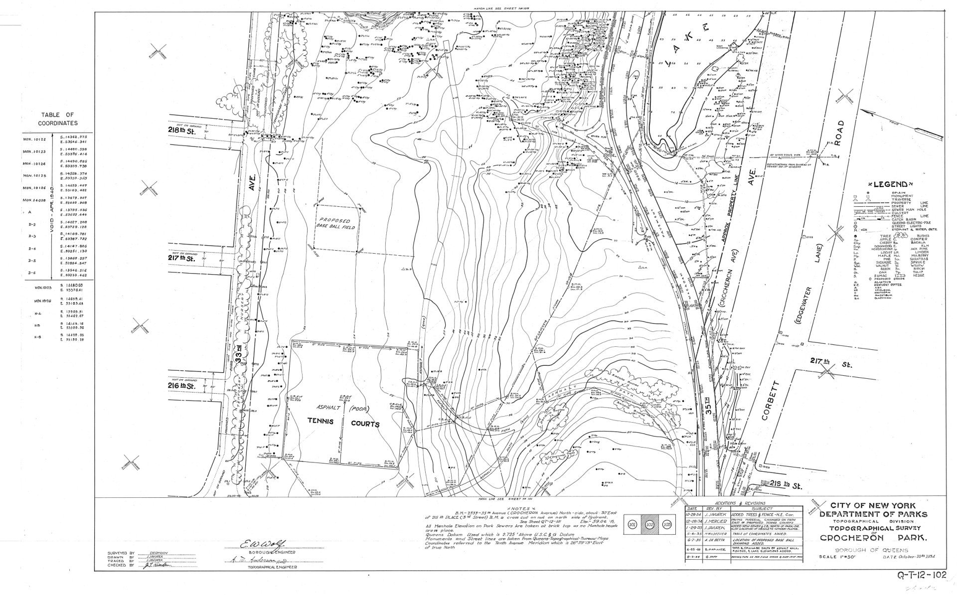
Crocheron Park Plantings (1930s)
NYC Parks Archives
Click on Map to Enlarge
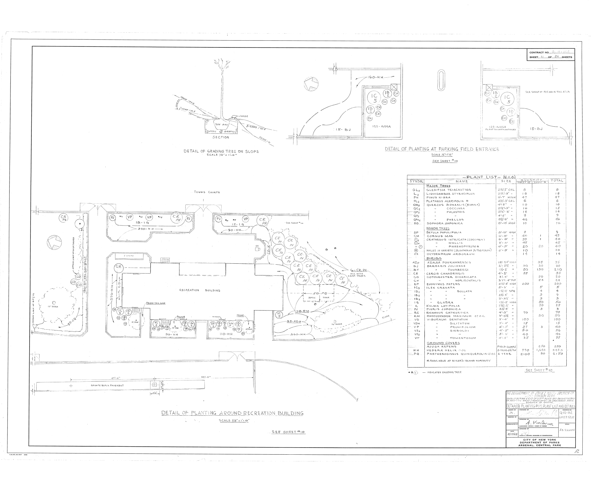
John Golden Park Plantings (1950s)
NYC Parks Archives
Click on Map to Enlarge
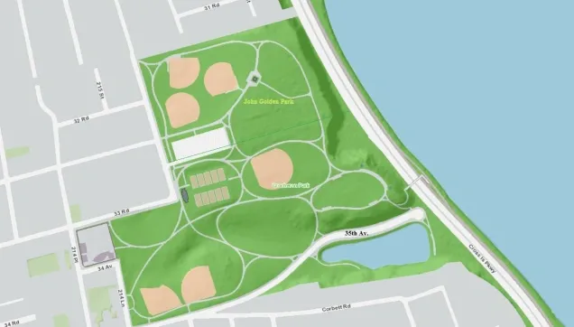
Crocheron & John Golden Park
NYC Parks map shows the paved trails and the main ball fields in the park. It also has some of the benches outlined.

Click on Map to Enlarge
Crocheron & John Golden Park (2020s)
Friends of Crocheron & John Golden Park created this map to highlight the amenities that the park has to offer.
Click on Map to Enlarge
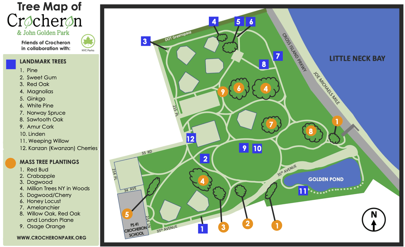
Crocheron & John Golden Park Tree Map (2021)
Our Park has a wide variety of trees. We look to expand and fine-tune this map in the coming months. Dana, volunteer and park steward with NYC Parks, worked with Friends of Crocheron to create this map.
You Might Also Like
Blog entry written by Charlotte Megill Hix is a genealogist and historian, author of six books, and countless articles. She has written the The Crocheron Family of Staten Island, New York.

We have ongoing work on Our Park's Pollinator Garden area and are looking for support for community events. We need your help to make it happen!